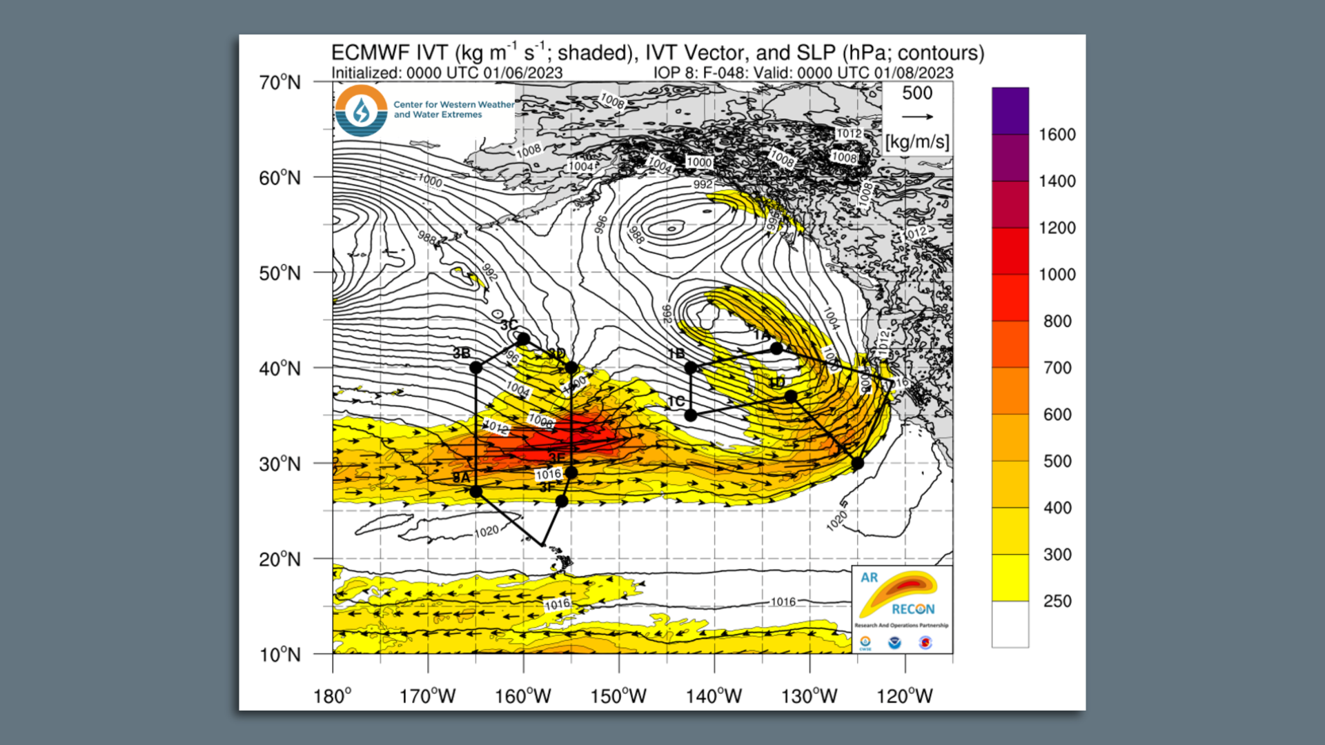
 Data: California Department of Water Resources; Note: The total capacity of the Oroville Dam is 3,537,577 acre-feet; Chart: Axios Visuals A "major" atmospheric river event is bearing down on California today, bringing with it the threats of widespread flash flooding, river flooding, mudslides, and staggeringly high mountain snowfall totals, Andrew writes. Why it matters: The whiplash from a bone-dry to flood-prone state is a demonstration of how human-caused climate change is accentuating California's naturally fickle precipitation regime. - While flooding, power disruptions and landslides threaten Californians in the near term, these storms are replenishing reservoir levels, left severely depleted by the Southwest's megadrought.
Threat level: With a "relentless parade of cyclones" lined up across the Pacific like planes inbound to SFO, these storms have the potential to cause deadly mudslides and debris flows in areas where the ground has been weakened by recent wildfires. - They are also priming the slopes of the Sierra Nevada Mountains for avalanches, as snow levels shift with each weather system, and up to 5 to 7 inches of snow accumulate per hour.
- Total snowfall through tomorrow is predicted to be up to 6 feet for elevations above 7,000 feet, per the National Weather Service. Some places have seen 100 inches pile up in the past two weeks.
- The NWS' Weather Prediction Center notes there is a greater than 50% chance that flash flood thresholds will be exceeded across a vast expanse of the state from Sacramento to the hills of Southern California.
Between the lines: The flood threat tomorrow looks to be centered more in Southern California, as the firehose of moisture concentrates there, with up to a foot of rain falling in the hills of Los Angeles, Santa Barbara and Ventura Counties. - Downtown L.A. could see up to 5 inches of rain.
What they're saying: "The timing, duration and time between each of potentially four more storms will be key to how flood impacts amplify, and drought conditions evolve," state climatologist Michael Anderson told Axios via email. - "Each individual storm may not be unusually large, [but] the impacts will be larger due to the number of storms and how quickly they arrive," he said.
Context: The hydrological whiplash from the depths of its worst long-term drought in more than a millennium to flooding is in line with what studies have been warning about for years — human-caused climate change is amplifying the effects of these extremes, making the dry years drier, and the wet periods wetter. What's next: There is no end to these storms in sight for at least the next two to three weeks. Read more | 


No comments:
Post a Comment